Rare 18thC Map Newfoundland Canada N America by Herman Moll 1739 Point Riche


$239.12
Date Range
1700-1799
Antique
Yes
Printing Technique
Copper Plate
Canadian Province
Newfoundland & Labrador
Year
1739
Era
1700s
Cartographer/Publisher
Herman Moll
Original/Reproduction
Antique Original
Country/Region
Canada, North America
Rare 18thC Map NewfoundLand Canada N America by Herman Moll 1739 Point Riche
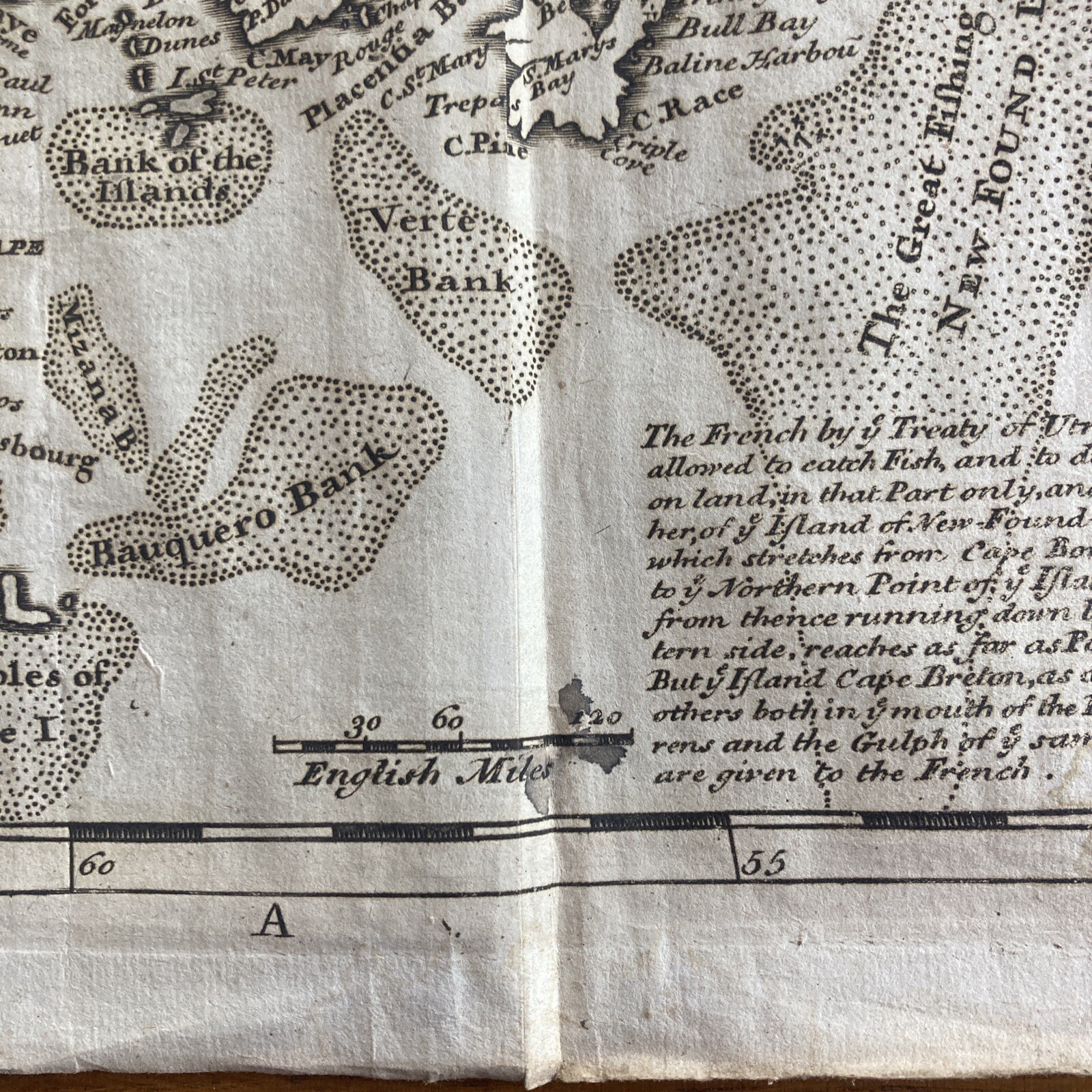
Map is by By Herman Moll Published in 1739 from the book Modern History or the present state of all nations vol. V part II being a continuation of the present state of America printed by George Grierson Dublin dates 1739.
The map mentions “Point Raye or Riche as some”
Also it mentions the treaty of Utrecht with French fishing rights
In 1763 the French attempted to an earlier edition of the map to establish their claim to the west coast of Newfoundland and Labrador, arguing that Point Riche and Cape Ray were the same headland. Governor Hugh Palliser and Captain James Cook found evidence to refute Moll's claim, and in 1764 the French accepted the placement of Pointe Riche near Port au Choix.
Size
Approximately 11.5” by 9” printed area is 10.5” by 7.75”
Condition
Map has edge wear and chipping along the outer edges mainly to the right hand side, there are creases down it with some light foxing and minor ink staining at the bottom Please see photos for detailed condition.
For more info or detailed photos just ask.
Please see my other antique Herman Moll maps of North America from the same publication I can combine postage
Will post world wide
US and Canada postage is £22